View Larger Map
Directions to Driving Tour Stop #2
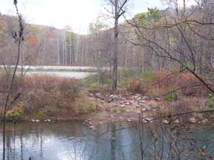
Cross the bridge over the Stonycreek River and proceed 0.6 miles uphill to a dirt and gravel parking area with a small strip of blacktop on the right which is the access area for Yoder Falls, McNally Bridge, and a historic trolley trace.
|
|
Latitude: 40.2439
Longitude: -78.8839
View Map
Print-friendly version
Driving Tour Stop #3
Carpenter’s Park was the nexus of trolley lines that connected with the City of Johnstown and the coal-mining communities of Scalp Level/Mine 40 and Windber. The lines followed the Stonycreek River from Benscreek through Kelso (Tire Hill) to Carpenter’s Park and the Paint Creek to Scalp Level and Windber. Residents would ride the trolley to this park, named for Johnstown hotel-owner Peter Carpenter, where they could picnic, swim, dance and socialize in a pavilion or hike over to Yoder Falls. The trolley line was abandoned following the 1936 Flood.
Today, Carpenter’s Park is a principal put-in and take-out area for boaters. It sits just beyond the Stonycreek Canyon’s 15 sets of Class III-IV rapids, and usually is the place where paddlers take out their boats after running the Canyon. However, it also is a put-in area for boaters interested in the 3.5-mile Class II-III section between Carpenter’s Park and Whitewater Park.
Related Websites:
|