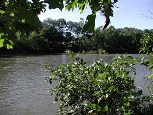
 From its origin in Pius Spring in Berlin, the Stonycreek slowly wanders for 10 miles across a high pastureland until it reaches the Glessner Covered Bridge on Township Route 565. Here, the river enters the “Upper Gorge” and drops 500 feet in elevation over the next nine miles before spilling out at the Trostletown Bridge on Township Route 647 just south of U.S. Route 30. The river’s “Middle Section” tends to be slow and shallow and extends for 11 miles from Kantner to Benson and Hollsopple. Below Hollsopple, the river enters the “Stonycreek Canyon” and produces a four-mile series of rapids during periods of higher water levels. Exiting the canyon just above Carpenters Park, the Stony enters a 3.5-mile “Lower Section” that offers a couple more rapids on its way to Whitewater Park at Greenhouse Park. The Stonycreek’s final seven-mile section, which ends in downtown Johnstown, is gentle. From its origin in Pius Spring in Berlin, the Stonycreek slowly wanders for 10 miles across a high pastureland until it reaches the Glessner Covered Bridge on Township Route 565. Here, the river enters the “Upper Gorge” and drops 500 feet in elevation over the next nine miles before spilling out at the Trostletown Bridge on Township Route 647 just south of U.S. Route 30. The river’s “Middle Section” tends to be slow and shallow and extends for 11 miles from Kantner to Benson and Hollsopple. Below Hollsopple, the river enters the “Stonycreek Canyon” and produces a four-mile series of rapids during periods of higher water levels. Exiting the canyon just above Carpenters Park, the Stony enters a 3.5-mile “Lower Section” that offers a couple more rapids on its way to Whitewater Park at Greenhouse Park. The Stonycreek’s final seven-mile section, which ends in downtown Johnstown, is gentle.
Five major tributaries feed the Stonycreek River, including two which drain the Allegheny Ridge and another two that drain the Laurel Ridge:
- Wells Creek forms near Somerset and drains 17 square miles.
- Quemahoning Creek, which forms on Laurel Ridge to the west, drains 99 square miles.
- Shade Creek, which forms on the Allegheny Ridge to the east, drains 98 square miles.
- Paint Creek forms on the Allegheny Ridge and drains 37 square miles.
- Bens Creek forms on Laurel Ridge and drains 42 square miles.
There are 14 communities near the Stonycreek’s banks, starting with Berlin and including (in order downriver) Shanksville, Kantner, Stoystown, Hooversville, Blough, Benson, Hollsopple, Maple Ridge, Foustwell, Krings, Riverside, Ferndale and Johnstown.
Related Links:
|