View
Larger Map
Directions to Driving Tour Stop #5
Return south to the intersection with PA Route
601 and bear left onto Bedford Street, which turns
into Graham Avenue. Proceed one mile into downtown
Windber.
|
|
Latitude: 40.2542
Longitude: -78.8461
View Map
Print-friendly
version
Driving Tour Stop #4
The rich Eureka coal field in The Stonycreek Corridor
helped to make the Berwind-White Coal Company one of the
nation's leading coal producers with customers that
included the New York City subway system and transoceanic
steamship lines. In the 1890s and early 1900s, Berwind
developed 13 Eureka mines and established a regional
headquarters in Windber. Eureka Mine 40 was one of
Berwind's largest and best-equipped Eureka mines,
producing 22 million tons of coal between 1905 and 1955.
The Mine 40 complex, including mining facilities and the
coal-patch community, was developed between 1902 and 1905
on farmland adjacent to the community of Scalp Level.
Ironically, Scalp Level and the Paint Creek valley below
it had been a favored destination of Pittsburgh-based
landscape painters for decades. Works produced by the
Scalp Level School of artists still are collected today.
Lumbering and mining activity badly degraded the
once-pristine valley and brought artists' plein-air
painting here to an end.
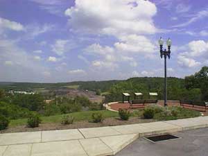
From the Overlook you can see more than 100 structures
that contribute to the Berwind-White Mine 40 Historic
District, listed on the National Register of Historic
Places, including mining-support buildings dating to the
first half of the 20th century, worker housing, and the
remnants of a boney (coal refuse) pile that now has been
largely reclaimed through cogeneration activity.
Related Links:
|

