 |
Members of the Benscreek Canoe and Kayak Club have been enjoying, developing and promoting The Stonycreek Corridor for almost four decades. Visit their website for information on local streams, stream gauges, rainfall data, kayak roll classes, and special events such as the annual Stonycreek Rendezvous and the Kiski-Conemaugh River Sojourn.
For more information.
|
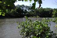 |
Class I-II Whitewater: For less-experienced paddlers, the Stonycreek River offers moving water with minimal whitewater in several sections. A 6.5 mile-section from Hooversville to Benson can be paddled when the USGS gauge at Ferndale shows a minimum of 4.5 feet. Almost 7 miles can be paddled from Greenhouse Park to the confluence with the Little Conemaugh with a minimum of 3.0 feet at Ferndale.
For more information.
|
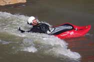 |
Class II-III Whitewater: Paddlers interested in more of a challenge can put in at Carpenter’s Park and float the 3.5 miles down to Whitewater Park. (Caution: A concrete-covered pipeline that creates a near-river-wide hydraulic below the Krings Bridge should be run on river-right.) Water should be a minimum of 3.25 feet, measured at the USGS gauge at Ferndale. Class III water also can be found on Shade Creek and Quemahoning Creek. (Caution: The Que Creek takeout is at the iron bridge in Quemahoning Lake. A Pennsylvania Fish and Boat Commission sticker is required of all boats on the lake.)
For more information.
|
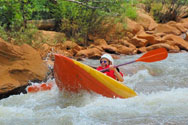 |
Class III-IV Whitewater: There are 15 rapids within the four-mile Stonycreek Canyon – all Class III or IV rapids when the USGS gauge at Ferndale reads 3.0 feet or higher (ideal conditions are 3.5-5 feet) making this one of the longest continuous sets of rapids in the East. The rapids are named Showers, Surf Lab, Lower Railroad, The Wall, Three Sisters (three separate and distinct rapids), Rooster Tail, Scout, Hydro, Beast, Backward Rapid, Pipeline (a potentially dangerous hydraulic that should be scouted), Hermit and Dislocation. The Canyon gets more pushy at 4.5 feet and offers expert-only conditions at 6.5 feet. (Caution: Border Dam should not be run but can be portaged on river-left).
For more information.
|
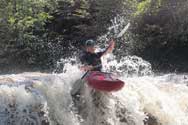 |
Class V Whitewater: When the runoff’s right, generally above 4.5 feet on the USGS gauge at Ferndale, Paint Creek offers expert-only water. The Stonycreek Canyon offers expert-only water when the gauge reads 6.5 feet
or above.
For more information.
|
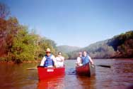 |
Kiski-Conemaugh River Water Trail: Starting at Greenhouse Park on the Stonycreek River, this water trail extends for 84 miles: down the Stony to the Conemaugh River in Johnstown, down the Conemaugh to the Kiskiminetas River at Saltsburg, and down the Kiski to the Allegheny River at Freeport.
For more information.
|
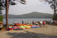 |
Quemahoning Lake: Because this is a water-supply reservoir, internal-combustion engines are prohibited and boats are limited to 17 feet in length. For paddlers who like their water flat rather than moving, this beautiful body of water can sooth the soul. Five miles long and two miles wide at points, it can also exercise the body. Note that a Pennsylvania Fish and Boat Commission sticker is required here.
For more information.
|
 |
Somerset County rainfall data: This gauge provides current rainfall data for The Stonycreek Corridor, which can be helpful in determining the water flow of tributaries. Pot Ridge covers Paint Creek; Forward can be used for Dark Shade, Roaring Fork, Clear Shade and Shade creeks; Berlin can be used for the Upper and Middle Stony. All gauges listed above can be used for the Stonycreek Canyon. To boat these streams there should be generally two inches of rain within 24 hours in the summer and one inch within 24 hours during the spring, fall and winter.
For more information.
|
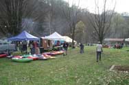 |
The Stonycreek Rendezvous traditionally is held toward the end of April each year and draws hundreds of paddlers from around the eastern United States for races, a rodeo and play-boating in the Stonycreek Canyon. Outfitters provide rafting runs and Class I events also are scheduled. Activities are based at Greenhouse Park and include food, vendors and live entertainment.
For more information.
|
 |
USGS River Gauge: The U.S. Geological Survey provides real-time water flow data along the Stonycreek River at Ferndale, just downstream from Bens Creek and five miles from the Stony’s confluence with the Little Conemaugh River. Boaters use this gauge to determine whitewater conditions upstream.
For more information.
|
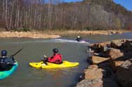 |
Whitewater Park: This is the first artificial set of rapids constructed for boaters and tubers in the state of Pennsylvania. Located adjacent to Greenhouse Park, this Class II water is a great place to learn how to paddle through hydraulics – or play in them. Tubing also is popular here. With its rustic look and the soothing sound of tumbling water, non-boaters also are drawn here just to walk, sit and relax.
For more information.
|
 |
Whitewater Releases: The Stonycreek not only features great whitewater, but it can guarantee it! Just upstream of the Stonycreek Canyon on Quemahoning Creek sits the Quemahoning Dam, which has a 500 cfs release valve. The valve is opened on a schedule that is published in advance, assuring boaters who are traveling some distance, that there will be whitewater to boat.
For more information.
|
|
Please note that due to the nature of this run-off fed mountain river system, water levels can change rapidly. Be aware of changing conditions. Characteristics of smaller streams especially can change dramatically as stream levels rise. |

