 |
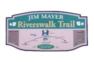
James Mayer
Riverwalk runs along the Stonycreek River from the
Moxham section of Johnstown to the village of Riverside in
Stonycreek Township. This groomed rail-trail features a
crushed limestone surface, Buttermilk Falls and a glimpse of
the 66-inch pipeline that provides water to Johnstown's
mills from Quemahoning Lake.
For more information.
|
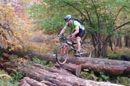 |
The
Alleghenies mountain-biking trail network includes a
cluster of single- and double-track trails atop Laurel
Ridge. Trails with flat or rolling terrain can accommodate
beginners - while others offer rock gardens galore for
advanced riders.
For more information.
|
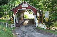 |
The
Alleghenies road-cycling tour routes include the
“Rivers and Bridges Scenic Tour” through The Stonycreek
Corridor. This 57-mile route is rated as challenging,
includes the Flight 93 National Memorial, and offers
impressive rural landscapes and an interesting list of other
sites.
For more information.
|
 |
Laurel Highlands On- and Off-Road Bicycling Association (LHORBA) is active throughout the corridor, providing group mountain-bike, road and rail-trail rides throughout the season. A network of mountain-bike trails explore the Laurel Summit and Quemahoning Lake is the gathering spot for road rides.
For more information.
|